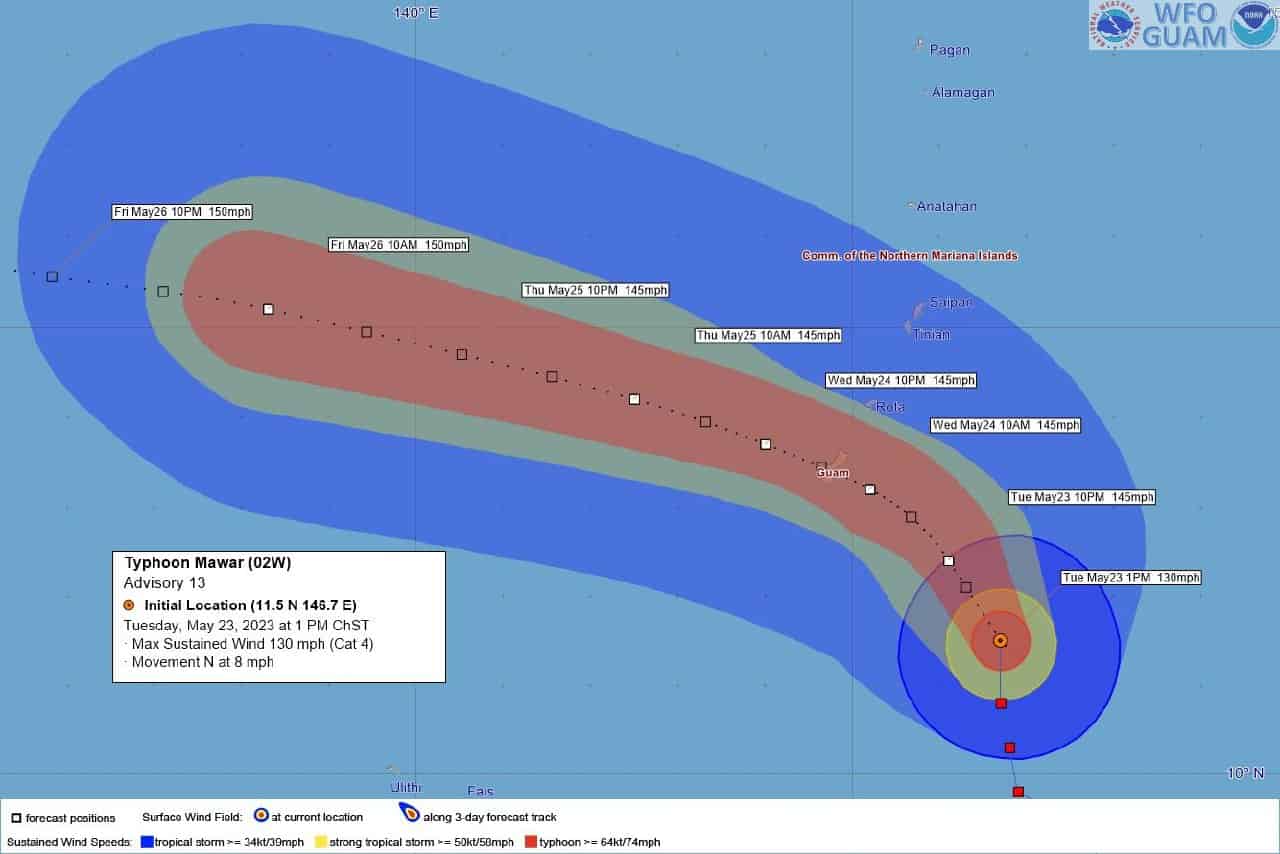
People of Guam have been advised to take precaution as a super-typhoon is expected to hit the island, according to the territory’s National Weather Service.
Typhoon Mawar has intensified into a category-4 typhoon.
Periods of heavy rain and increasingly stronger gusts are expected this evening,
Residents who are not in a fully concrete home, including a concrete roof, are advised to find shelter elsewhere.
According to Pacific Daily News, Gov. Lou Leon Guerrero has ordered the evacuation of residents living in low-lying and coastal areas.
“This is becoming a very grim situation for Guam,” warning coordination meteorologist Landon Aydlett said during an 8 a.m. update on Facebook. Guam can expect damaging winds, starting Tuesday afternoon or evening, with typhoon-force winds early Wednesday.
As of Tuesday 1p.m (Guam time), the typhoon was 190 miles southeast of Guam, moving north at 8 mph, with maximum sustained winds of 130 mph.
“This could become a category 4 typhoon later today — something that will be a significant threat to folks on Guam — something that we need to be very serious and focused about,” Aydlett said.
A category 4 typhoon has maximum sustained winds as high as 156 mph, with gusts to 197 mph.
“Right now, we’re looking at Wednesday afternoon with 140 mph winds right over a good portion of Guam. We’re going to be seeing some torrential rains, some significant flooding concerns, significant coastal inundation,” said Weather Service science and operations officer Brandon Aydlett, who is Landon’s brother. “Think of some of those really devastating flood events — Typhoon Omar — we could be seeing a near repeat of that situation.”
Omar passed over Guam in August 1992 as a “super typhoon” with estimated wind gusts greater than 150 mph, and caused about half a billion dollars in damage. “Typhoon Pamela, Typhoon Omar — they were similar strikes to the island with similar conditions,” Landon Aydlett said.
