The Blue Prosperity expedition programme to collect data on ocean health in Fiji is already showing very mixed results at different sites.
The programme is a collaborative effort led by the Fiji government and supported by local NGOs, the University of the South Pacific, international scientists, and the Waitt Institute. The expedition began in May and continues until the end of August.
It is Fiji’s first nationwide marine survey and will update information collected from sites covered in the past.
“This was informed by the need that the government has at this point in time to better understand what our marine ecosystem looks like, and what the status of our reefs is so that they can then use that information to develop management plans at the community and national level that can better manage our marine resources,” says Blue Prosperity country manager, Arthur Irwing Sokimi.
At the launch of the expedition in May, Fiji’s Minister for Fisheries and Forestry, Kalaveti Ravu noted that: “The expedition will help us understand the health of our coral, the status of our fish stocks, and the quality of our waters across our island so that we can make informed decisions and interventions about how to be responsible stewards of our oceans and their resources.”
Acting Permanent Secretary for Fisheries and Forestry, Atelaite Rokosuka concurred, saying the data government currently has is ten years’ out of date.
Protecting traditional owners’ interests
The expedition’s co-primary investigator, Dr Joeli Veitayaki, says the process will move from data to storytelling to planning and implementation within government. He says it is “arguably the most significant new development commitment the country has taken to attain a sustainable use of marine resources.”
Dr Veitayaki says one reason an expedition of this magnitude has not been undertaken previously is the lack of funding to cover surveys of Fiji’s 411 i-qoliqoli (customary fishing grounds which extend from the high-tide water mark along the shoreline to the most outer reef crest).
“The intention is basically to try and provide all the qoliqoli that can be covered in this exercise, the information that can then be used to build the database that we hope you can make the basis of marine spatial planning, so in years to come, hopefully with layers of data, policymakers and planners can then be assisted by these programmes to make better decisions.”

The team has approached more than 100 communities to conduct research in their waters. Those communities have raised some interesting suggestions during the consultation process, Dr Veitayaki says.
“One, for instance, is that ‘Okay, the government forms the i-qoliqoli, but maybe the government should also help with the enforcement of management arrangements being undertaken by the local communities’, because they are saying sometimes they try to enforce, but then they end up on the wrong side of the law.”
He continues: “We have undertaken the responsibility to ensure that the data that is shared with the government also gets returned to the customary owners for their own planning purposes.”
Dr Veitayaki says the surveys should address important questions for the local people regarding their fishing areas, whether they think the environment is as productive as in the past and how it has changed, how they can use the information to protect the interests of their future generations.
Early results
Arthur Sokimi notes that the scientists are already seeing clear differences in data collected between Nadi, Suva and Kadavu waters to the south.
“We were in Kadavu yesterday (May 24), and it was absolutely pristine, with very nice reefs with fish.
“We started off in Nadi on the 15th (May) and we made our way slowly towards Suva for the launch [of the expedition], and just as a general observation, there are differences we’ve observed; some areas have plenty of fish, others not so much,” he said.
A Scripps Institute of Oceanography marine biologist with the expedition, Katie Lubarsky, says there are several factors affecting fish size.
“Overfishing is one of the reasons, particularly the big fish, get fished out because they are more desirable; the habitat is also important; more complex habitats give more place for the fish to live, and so depending on the structure of the reefs, you may see more or less fish.
“And also [it depends] on the health of the coral, because as the coral degrades, the habitat degrades,” she notes.
The expedition team consists of marine biologists, local experts, WWF and government representatives. Islands Business interviewed them as they were preparing to get back into the water to continue their scientific observations.
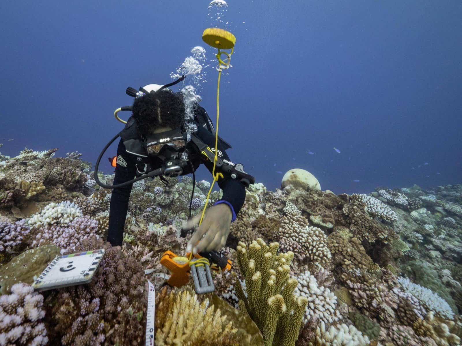
“We’ve got cameras, slates for fish identification, for invertebrates, and other equipment to help set up plots underwater around 10 metres deep that allow us to do photo mosaics,” Sokimi said.
Such equipment helps make data collection more efficient.
Lubarsky adds: “From our photos, we get to understand how much of the reef is coral, how much is algae, and how much is invertebrate, which is a really important indicator of reef health.”
Sokimi says more than 40 sites have been completed, although some site surveys were cancelled due to weather changes and surges.
The team also includes Pacific Blue Foundation environmental officer and USP Masters student, Ulamila Matairakula, who was part of the group tasked with collecting coral data.
Matairakula said: “The coral data is collected and extracted from the pictures in the camera, and they will analyse the data in terms of coral growth, different diversity of corals, and all the coral diseases.
“So different areas have different coral structures; for example, if you go to Malolo and compare it to Beqa, you would have different types of corals in those different areas, different diseases of corals, and you will understand that maybe these waters are more polluted, or maybe people close to Malolo are using this kind of fertiliser that disrupts coral reef structure.”.
Sokimi says it may take a while to synthesise and present their findings due to the amount of data to be collected and analysed.
“That is going to be quite a process, because we don’t want to rush the site, so things will get back to the lab, submit all the photos, all the data, all of its own analysis, the process, and so we cannot give a fixed date,” he said.
“Everything (the data) that comes from this belongs to the government of Fiji, so the government will store it safely locally and make it available to partners.”