
Pacific Island Countries are known to host some of the most memorable soirees during the festive season, but are also the most vulnerable to extreme climatic events during the same.
El Niño (pronounced ‘el neen-yo’), literally means ‘the boy child’ in Spanish and was used by South American fishermen in the 17th century, because it is linked to the El Niño Southern Oscillation (ENSO) phenomenon, which has the greatest impact on countries around the Equator.
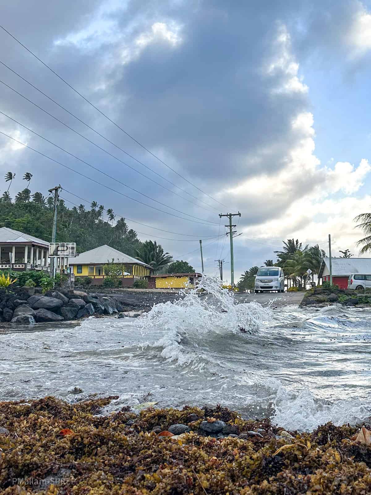
El Niño events occur when there is a decrease in the strength and intensity of trade winds, which alters the position of the warm pool in the Western Equatorial Pacific, causing warmer than average ocean water to migrate into the Central and Eastern Pacific, typically resulting in above normal rainfall. The countries in the Western and off-Equatorial South Pacific, such as Vanuatu, Fiji and Tonga, tend to experience below normal rainfall which sometimes leads to prolonged drought events.
Historically, El Niño events tend to be associated with hot days, cold nights, drought and flooding – the impacts vary depending on which country you are in. The last significant El Niño event declared in the Pacific was in mid-2015 through early 2016. El Niño-like conditions in late 2019 and early 2020 caused some countries in the Pacific to experience drought-like conditions.
In October, the Pacific Regional Climate Centre-Network convened the thirteenth Pacific Islands Climate Outlook Forum (PICOF-13) in Nadi, Fiji. PICOF-13 was well attended by over 105 participants, from 17 Pacific Island Countries, with a focus on strengthening food security in the Pacific with climate services. PICOF-13 is a joint event supported by the EU-funded Intra-ACP Climate Services and Related Applications Programme (Intra-ACP ClimSA) SPREP and the Australian and New Zealand Aid funded Climate and Ocean Support Program in the Pacific (COSPPac).
Ironically, as the Pacific discussed the implications of the impacts of El Niño, Tropical Cyclone Lola rapidly developed into a severe Category 5 system over Vanuatu, reminding us that out-of-season and intense cyclones are one of the traits of the phenomenon.
In the PICOF-13 Statement, all Pacific National Meteorological Services reiterated that El Niño is expected to continue through at least March 2024, peaking in December 2023 or January 2024, and will likely be a strong event.
Overall implications for the Pacific region indicate that there will be drier than normal conditions for much of the off-equatorial North and South Pacific, between southern Papua New Guinea and Southern French Polynesia, and between Palau and the northern Marshall Islands. Above normal rainfall will be experienced by countries along the equator, extending from Eastern Papua New Guinea to the Line Islands of Kiribati, including Nauru, Tokelau, and Tuvalu.
Warmer than average sea surface temperatures (SSTs) will be experienced in most of the region, except in New Caledonia, Vanuatu, Fiji, and Niue, where near average conditions are likely. Slightly higher than normal sea levels are predicted along the equator, which may lead to a risk of coastal inundation around Kiribati, especially during the highest tides.
In contrast, lower than normal sea levels are forecast for the western part of the region, near Palau, the Federated States of Micronesia, Marshall Islands, Papua New Guinea, and Solomon Islands, which means that the combination of lower sea levels and warm seas may lead to coral bleaching in these countries. Coral bleaching may also occur in Tokelau, Tuvalu, Kiribati, Northern Cook Islands, and Marshall Islands.
During the PICOF-13, the RCC-N partners indicated that 4 – 8 severe tropical cyclones, reaching category 3 or higher might occur anywhere across the region.
Whilst the characteristics of El Niño events vary between countries in the Pacific, one thing for certain is that the impacts on all sectors, including agriculture, fisheries, health, tourism and infrastructure among others, last beyond the event and have cascading effects with adverse economic implications.
With the El Niño event we are currently experiencing, agriculture, fisheries and water management are the main sectors that will be affected. Impacts include the effect of marine heatwaves on fisheries and the impact of extreme temperatures and humidity on crops. The SST convergence zone that forms the boundary of the Western Pacific warm pool is an important feature for tuna fisheries, with a high correlation to skipjack abundance, which could result in a higher than usual tuna population around Kiribati.
El Niño cannot be avoided, but its adverse impacts can be reduced. All Pacific Islanders are encouraged to be vigilant and prepare, not just for tropical cyclones, but for flooding, coastal inundation and low rainfall leading to drought. For more detailed information regarding your country, contact the National Meteorological and Hydrological Services in-country, as they provide frequent forecasts and alerts.