SOME achievements are broadcast to the whole world, and the recognition and accolades flow in almost immediately.
Others toil away behind the scenes, but what they accomplish is no less momentous.
New Caledonia’s David Guivant — and what he is trying to achieve — falls somewhat into the latter category.
For nearly a decade, David has been documenting his homeland; in the process setting his sights on a world record.
“I’m aiming for the title of the world’s most prolific Google Maps Contributor by uploading the highest number of unique photos ever recorded on the platform.
Pako Valera, with 800,000 photos from Turkey and Spain, is the one to beat.”
An offhand tease from a former manager stands out in Guivant’s mind as the catalyst for his world record attempt.
“Back in 2017, I had already posted around 4,000 photos of New Caledonia to Google Maps. My former manager teased me, saying, ‘4000 photos? That’s crazy! Are you trying to beat a world record or something?’ I laughed and replied, ‘Sure, why not? I’ll do it.'”
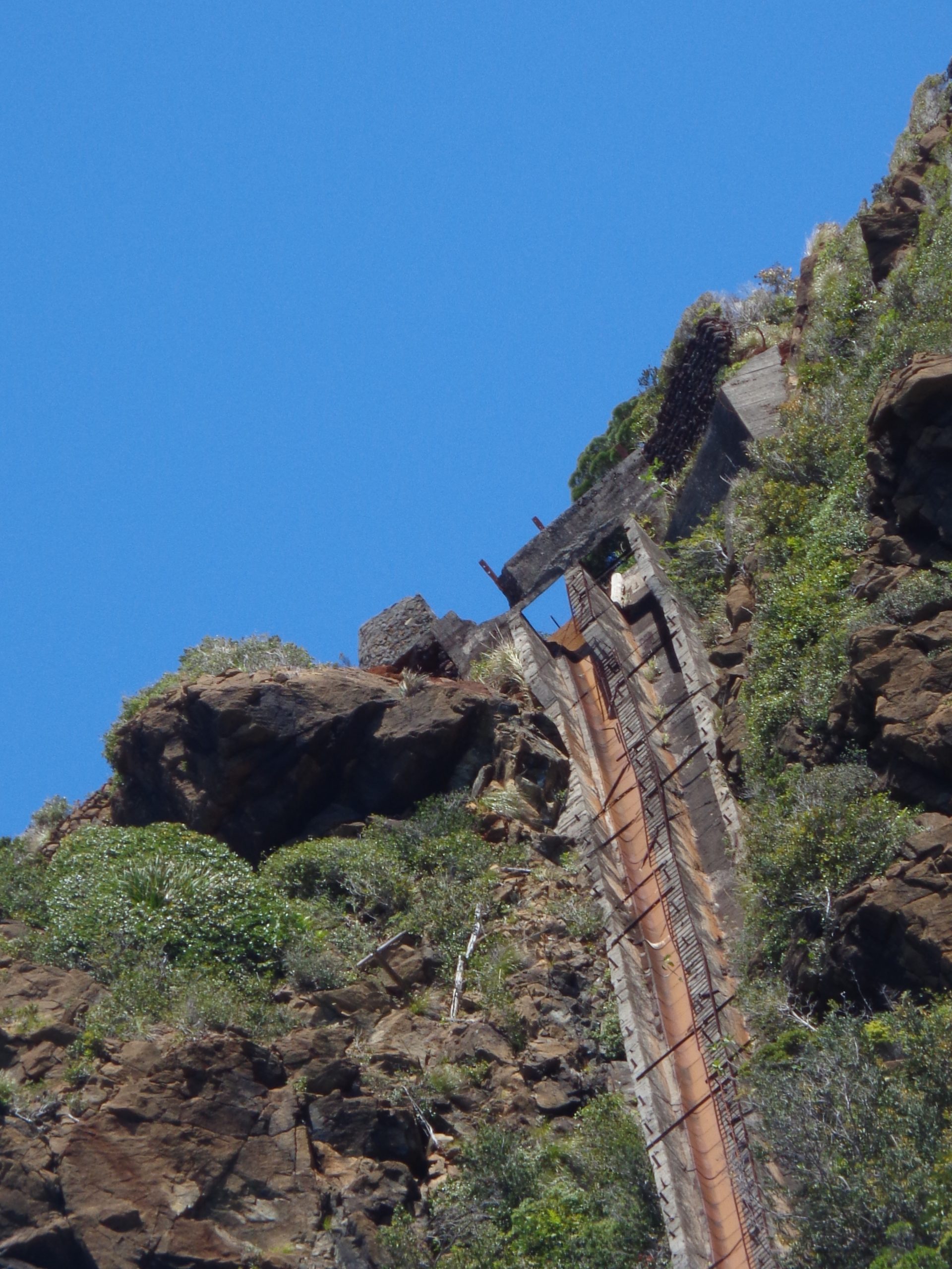
Now armed with his trusty Sony DSC-W830 or smartphone, David travels the length and breadth of New Caledonia, hunting for and documenting what he calls the country’s hidden gems — Jacob’s Peak, Mê Paaya Mountain, Wadiana Falls, and even an abandoned Japanese iron mine, to name a few.
The journey up to this point has not been easy and has required great fortitude and discipline on David’s part to overcome illness and injury.
Paradoxically, it has also been part of the healing process.
“This journey has been a years-long process of physical and personal transformation. Following four heart attacks and a spinal injury that ended my weightlifting days, I faced a significant health crisis due to inactivity. Walking became my lifeline. What started as a necessary health regimen evolved into a passion for ‘digital trekking.’ Having a different focus for my mind has been just as important. I have been constantly documenting my travels since 2017. Every step I take to discover new landscapes, historical landmarks, and archaeological marvels is a step toward this record. For me, photography isn’t just about the data; it’s about the joy of discovery, and it allows me to forget my health struggles.”
Just as the world record attempt has been a personal journey of discovery for him, David hopes not only to bring the beauty of New Caledonia to a global audience but also to increase awareness at home.
It amuses him that many in New Caledonia don’t even know what Google Maps and Street View are.
Despite this, if the numbers are anything to go by, he is getting engagement with his page — just this week, passing the 200 million views milestone.
“It’s a marathon rather than a sprint,” David said, with every step being verified through Google’s contributor system.
He and his friend Emryck, a former ambulance driver, have so far covered around 10 per cent of New Caledonia in a borrowed vehicle.
Getting to the root of what motivates and drives David to pursue his world record feat was not hard. He was straightforward and clear about it.
“My journey is ruled by faith and patriotism. Pursuing this goal allows me to focus on the beauty of God’s creation, providing a vital distraction from my personal health challenges. Despite being a native, I am only now uncovering the full extent of my country’s landscape.”
He hopes in the future to be a guide for scientific and archaeological personnel interested in exploring sites he has documented, including architectural anomalies such as pyramids and prehistoric structures, fossilized prints and remains that locals associate with the Nephilim described in Scripture.
“Emryck and I would be honoured to act as guides for those looking to uncover the island’s hidden history. I want to show that there is always something new to discover. Sharing my finds on Google Maps is my way of cataloguing the ‘closest Island to Heaven’ and making it accessible for everyone to see.”